
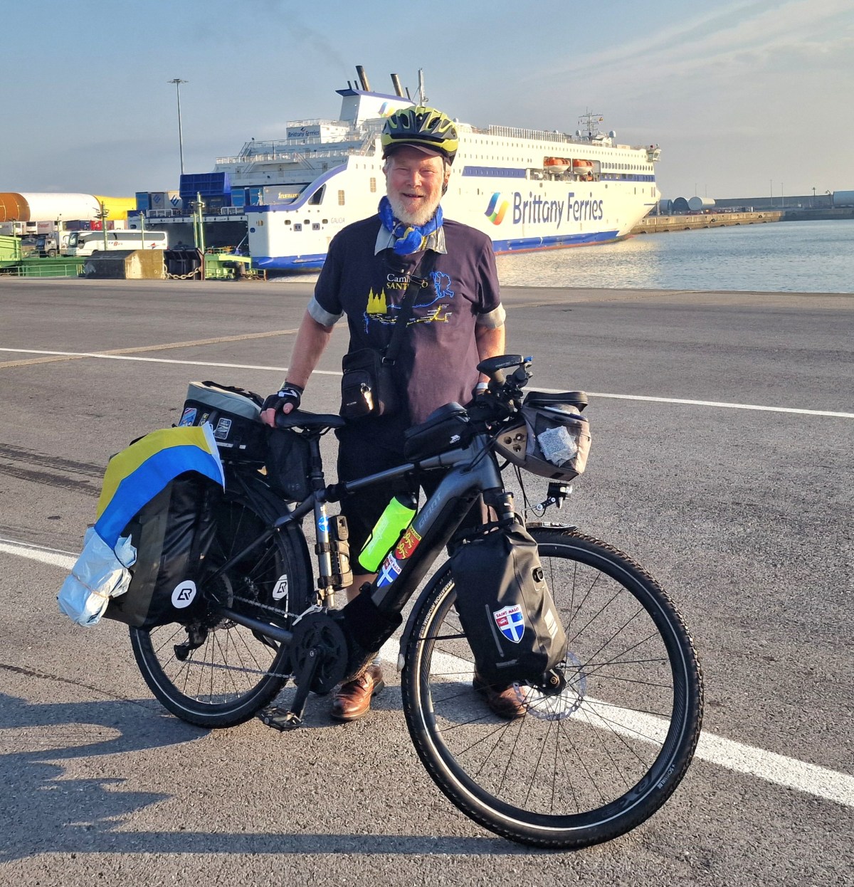
Sometimes tough but fascinating and unforgettable and meeting wonderful people!
- Click HERE for my day by day diary.
- Click HERE for the cycling stats
- Click HERE if you would like to make a DONATION.
With this trip in 2026 ride I have now completed 14 long-distance cycle rides in Europe starting in 2014. I have planned and led all of these. Two of these have included Spain, but the rest have been in France. The new feature if this trip in 2026 is a cycling from Spain through France back to England. Also, this ride brings my total SOLO rides to 3.
In 2025, I completed two long-distance bike rides, one from the south of France to Dieppe, and the other from Roscoff to Dieppe. The former was promoted to help raise money for Ukrainian medical supplies. This year, I’ve I have also used the trip to raise money for charity. I’ve completed a long-distance bike ride and also raised over £3,000 for medical aid for Ukraine.

If someone were to ask me what the best part of this journey has been, my answer would be immediate: meeting interesting people. Throughout the trip, I have encountered some truly wonderful characters, many of whom appear in my daily diary. Even during the final hours of the journey, in Saint-Malo, I continued to meet people whose kindness, energy and friendship will remain among my strongest memories of what has been a remarkable adventure—even if it was gruelling at times.
The 2026 ride
This journey was much more difficult than I ever imagined. I think it’s mostly due to the heat. I had some other issues on the way, which could happen at any time, for instance, I was ill for a few days. My daily diary can be seen HERE . If you would like to DONATE please click HERE. My summary of my 2026 trip is here:
The Basque Country hills!

I was very concerned about cycling through the Basque Country. I knew it was hilly, but online and in actual real maps, paper maps, you couldn’t find out very much about the route. There was nothing like the Ordnance Survey or the French IGN map system, so that left me with concerns. My concerns were partly alleviated by the fact that it was a Saturday when I was cycling away from Bilbao, and that meant the traffic was light, and there were lots of cycling groups out on the road. That gave me confidence. I had to use a main road coming out, but then eventually I turned off towards Guernica, which was my first stop. That part of the route was quite hilly, and it just forewarned me about the few days that were to follow.
Guernica
Because I was raising money for medical aid for Ukraine, I felt I had to come to Guernica. This was the place where aerial bombardment of civilians first took place in 1937 as part of the Civil War, with General Franco getting assistance from Nazi bombers to obliterate the town. No thought was given to civilians. Today, President Putin is doing exactly the same thing, targeting civilians. It makes me both immensely sad and angry.

Heat and Hills
After Guernica, the steepness of the hills became a lot more serious. I was heading for the coast and imagined that I could go much further, but this is where the heat and the steepness of the hills kicked in. Over 35 C in the shade and over 2000 m of ascent in 3 days (over 6,500 ft).
However the coastline was stunning. I would have liked to have spent more time in Jean de Luz and San Sebastian, but with hundreds of miles yet to cover, I just had a brief one-day visit in both of these places.
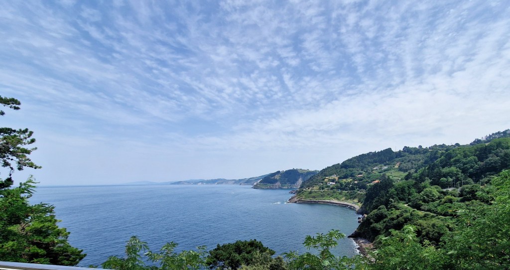
However, I can say the holiday mode was in full swing with lots of people on the beaches and a very vibrant atmosphere in the town in this.

France!
By the time I got to the French border I eventually found my way onto La Vélodyssée (Euro Velo 1). [This route is some 1,300 km (800 miles) long through France. I didn’t do all of it as my destination was St Malo.]. The route actually goes on to Roscoff in western Brittany.
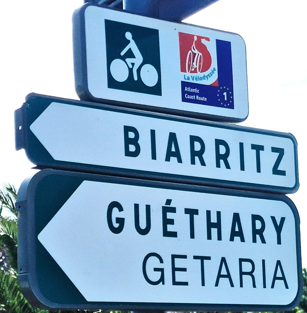
The EuroVelo Route 1 (EV1) begins to be marked here. Not always that clearly and I got lost a few times. Cycling into some of the towns along the coast from San Sebastian, and into Biarritz, and then beyond Biarritz, is on clearly marked cycle paths. They are super! I wish we had this sort of cycle path system more widely in England. Sometime though one is cycling on roads but thought the journey I found that the motorists were very kind. I didn’t cut you up or hooted once thought the journey in Spain of France! Even the lorries gave me a wide berth!
In some ways, the path was easy to follow because it was a dedicated cycle path, and there were lots of cyclists on it. Sometimes cyclists were more dangerous than car drivers! By this time, my Garmin had lost its connectivity with my mobile phone, and to be honest, I didn’t have the patience to try and get it reconnected. As I’d been doing before, I was just using the Garmin to track my route so I knew exactly how far I’d been and what the ascent was. In it’s place I used the French IGN mapping tool on my mobile.
I had imagined that the cycling up through the west coast of France with its pine trees and long flat areas would be easy, but in fact it wasn’t. The problem was there were lots of little hills and deviations, which meant the additive effect of all of the ascent in a day would be very high. For instance, on one day, the ascent was over 800 m (2,600 ft). However when you look at the map, it looks as though the land is flat. This stretch was the hottest. The heat really took toll, and I couldn’t reach some of the destinations I wanted to get to, so I had to limit the distance so I could cope with the heat.

On occasions, the routing of the EV1 was not clear, and this is where I was grateful for my French version of the OS map, the IGN map. It was brilliant. You could look at that on your mobile phone, on your handlebars, and you could see exactly where you were going, and it was much better than the Garmin for finding routes and cycle paths. From here on in, I began to rely upon the French IGN map app.
When I reached Arcachon, I took the ferry across a beautiful stretch of water to Cap Ferret. (This where the forest fires started two days after I passed through). This saved at least 25 miles of cycling. But the ferries were quite small. I had to work hard to persuade the ferrymen, the boatmen, to take my heavy electric bike. I must admit, the Giant Explore is a bit of a tank. We stripped everything off, and they hoisted it onto the roof of the ferry, and off we went.

Back on dry land again, the route continued up through the forested areas of the west coast with its long sandy beaches and inland forest. The forests were much more extensive than I remember. The paths were mostly good in parts, but sometimes you were slowed down by the tree roots, which had burrowed underneath the path and made it very bumpy. So there were those types of things, and also this question of weaving in and out and there being little hills, which when you multiply them all up for the day, really does add up to quite an ascent.
After a few days, one eventually leave this pine forest area with its myriad of French campsites and wide sandy access paths to the vast sandy beaches off to the west. Coming to Pointe de Grave , where the ferry takes one across to Royan was really a pleasure. The landscape changed, and the cycling was along a picturesque coastline. Further on the route turns inland towards the estuary of the river Charente. By now we’ve left the Gironde area, and we’re in the La Charente department.
Another estuary has to be crossed, and this time, unfortunately, the only way is to go over a very high bridge. Because of the wind, which I think is an important thing when you’re cycling, I decided that I have to walk my bike over that bridge. It was very blustery and buffeting. Again, this is something one would have to factor in, which I didn’t in my planning, as it adds time to your cycling.
Despite the challenges of the wind and crossing a long, low, marshy plain, rather like Pevensey Levels, with the wind blowing sometimes against you, I eventually come to Rochefort, which is a fascinating place. It once was a major naval port of France during the reign of Louis XIV.

Unfortunately, I became ill (not French food but a Vietnamese takeaway). I had to take a few days off. Feeling better I cycled on to the historic port of La Rochelle. Here I found I had problems with my bike. One of my panniers had ripped apart, and I was still not feeling too good. So the next day I caught the train to Nantes in order to get to a Giant dealer who could fix my bike, and where I could rest up in a fairly cheap hotel before moving on.
Now fully recovered as you will see from my diary, I had some very pleasant rides from there on up to atmospheric and picturesque old port of Dinan on the River Rance before cycling on to Saint-Malo.

The whole of the trip was, despite the heat, despite the illness, and despite all the problems was not to be missed and best of all I loved meeting the people, and I think 650 miles is a very respectable achievement for a 79-year-old, even with an electric bike.
For more details, see my daily diary, which I hope you will find interesting and amusing and informative.


